Labels

Wednesday, 25 March 2020

Yarramundi

Flood damage at Yarramundi

To-day Ken and I drove down to the Southern side of Yarramundi Reserve, one of our favourite places, as we wanted to escape from our self-imposed isolation, due to the corona virus outbreak. 

Yarramundi Reserve is a place for public recreation and environmental protection and is located at the confluence of the Grose, Hawkesbury-Nepean Rivers.  It is a place we often visit as we particularly like to photograph the birdlife in the area. 

We were shocked to see the devastation of this beautiful area caused by the recent floods a few weeks' ago.  We saw whole trees uprooted and lying on their sides and lots of debris lying scattered around the area. We were prevented from progressing any further at one point on the track, due to a trickle of water, too wide for us to traverse and had to be content to just look and see beyond this point.  It was heartbreaking to see many magnificent trees completely uprooted and we feel it may take many years for this area to completely recover from the impact of this destruction.

Here was a tree uprooted by the floodwaters and lying across the track at a precarious angle.  It was terrible to see trees in this state.  The force of the water must have been very strong to cause whole trees to be uplifted. 
We came to this point on the track where the water had created too large a channel for us to traverse. We turned back and went for a walk around the other side of the Southern lagoon where we saw further devastation.  Trees and branches were lying across the path and we had to pick our way carefully around the obstructions.
Here is the Yarramundi Bridge across the river and, at the height of the floods, this bridge was impassable due to the high water level.  When this happens, a flood notice is placed on a signpost along Hawkesbury Road, at Winmalee on the opposite side across from our house.  This is to warn motorists that the bridge at Yarramundi is closed to all traffic.
Some of the debris caused by the recent floodwaters inundating this area.  This picture was taken on the track around the other side of the Lagoon.  We could see, from marks on trees, that the height the floodwaters reached was well above our heads and it was hard to imagine the area being completely under water!


"During the beginning of last century, sand was mined from this area to meet the demand for high quality river sand for public buildings, including the Sydney Harbour Bridge.  Sand and gravel continued to be extracted until 1989.  The extraction activities have altered the landform of the Reserve.  The large lagoon on the Southern side of the Reserve is a flooded former excavation pit and now a refuge for many species of birdlife." (www.hawkesbury.nsw.gov.au)

The Reserve is prone to flooding and I can remember other times when this area has been damaged by flooding.  In time, it will recover and I guess, when you put it in perspective, it is a natural occurrence.


                                                                                         

Friday, 13 March 2020

Penrith

East Bank, Tench Reserve, Penrith

On 12 March we drove down to one of our favourite spots, mamely Tench Reserve situated along the Nepean River at Penrith.  We took a picnic lunch with us, but noticed since we had last visited this Park, a great new Restaurant Precinct had sprung up along the Great River Walk near the boarding spot for the Nepean Belle Riverboat.  It was a surprise to see such a great complex of restaurants, cafes, bars and other eateries in one of our favourite haunts and, we decided that next time we would ditch the idea of having a picnic and head for one of these great new eateries for lunch.

Nonetheless, it was still very nice to sit outside in one of the picnic sheds and enjoy our picnic lunch and, at the same time, admire the beautiful scenery along the river.  It was a lovely sunny day and quite hot for Autumn.  Unfortunately, whilst eating our lunch I had a violent attack of hiccups and burst a blood vessel in my right eye, causing me some distress, as my eye became very bloodshot and rather sore.  However, we finished our picnic and continued to walk along the path, looking for birds to photograph and I enjoyed the rest of the day, despite the discomfort of my eye.

This was near our picnic shelter and a similar shelter can be seen in this photo.  There are also barbecues available.  There are many lovely trees in the park with great habitat for the birds. 
 A view of the river through the trees.  It is not possible to walk along the bank, as there is not enough level land beside the river as it rises steeply in parts.  There were many ducks and water birds near the water's edge.  I saw a Little Black Cormorant sitting on a branch, drying his wings.
Here is a view of the new East Bank Restaurant Precinct along the Great River Walk and along the Eastern bank of the Nepean River.  It is 8 minutes from the CBD of Penrith.  It is situated down the far end of the Reserve and near the bridge on the M4 motorway.
Here is another one of the Restaurants in the Complex.  There is also Goji Bar and Restaurant a fusion of flavours from across Asia, Maldini's Cafe and Pizzeria with alfresco Italian dining, Tella Balls Dessert Bar and Onshore Sea food selling fresh seafood and juicy burgers.
The Lone Star Rib House will be opening shortly and there is also Riverbank Wine Bar   There are so many choices and I think it will be a wonderful boost for this popular spot by the River.
The Coffee Club.  This is one of the Restaurants I would like to try.  There is one in Westfield at Penrith which we have been to many times and it is one of our favourites.


I think the East Bank Restaurant Precinct is a wonderful addition to this popular area and has brought a touch of a cosmopolitan lifestyle to the suburbs of outer Western Sydney, similar to other waterside complexes in other cities.

Wednesday, 26 February 2020

Cordeaux Dam


Cordeaux Dam

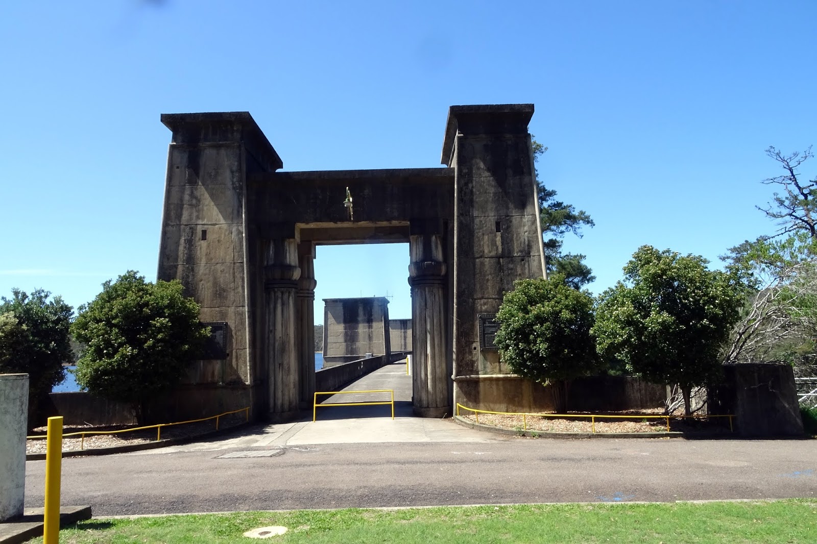
Yesterday,  we joined our friends from the Avid Travel Club for a trip to the heritage listed Cordeaux Dam.  It is one of four dams in the catchment of the Upper Nepean Scheme.  It is situated 94 kilometres south of Sydney.  On the way down to Wollongong it is off the Picton Road.  It was created by damming the Cordeaux River.  Cordeaux Dam is a very well built and handsome  structure, with a strong Egyptian styled architectural character which suits the monumental nature of the structure.  It was built of sandstone blocks, quarried at the site and has the longest dam wall of all four dams.  Massive Egyptian style stone gateways guard the entrance to the dam wall, complete with Lotus Columns and the leafy picnic grounds feature stands of tall palm trees and other reminders of past times.

Here is the Entrance Gateway to the Walkway across the Dam wall.  The Dam is 57 metres high.   You will notice the neo-classical and Art Deco influences in the design of the Gateway and the structures along the Walkway.  
 Here is a detail of the top of the Lotus columns inside the main Entrance Gateway.  The great columns suggest an origin in pre-classical times, their bulges and fluting harking back more to Ancient Egypt or Babylon than Greece.
I love the view from this little window, which is inside a room at the far end of the Dam wall.  The Reservoir holds 93 megalitres of water supplied from a 91sqm catchment which forms a vast lake of water. 
A very pretty view along the shoreline of the Lake.  The Dam is set within the valley of the Cordeaux River.  Upstream of the Dam wall this setting is characterised by the broad expanse of the Lake bordered by the crests of the valley sides. 
Looking towards the end of the Dam wall.

The concrete battlements over the top of the Dam hide a footing of vast stone blocks carved from the surrounding area and which make up the bulk of the dam itself.
Technical Details.  (taken from www.stonequarry.com.au)
"Cordeaux Dam. Completed 1926. Masonry dam (sandstone), with 218,440 cubic yards of concrete. 1,327 feet wide; 996 feet above sea level when full; 156 feet deep. Lake is 1931 acres in size. Catchment area 35 miles square. Average annual rainfall 56". Try converting this to metric!
Part of the water catchment area for the city of Sydney.
But how does it get to Sydney?
While you are gazing at the dam you are only seeing part of this engineering marvel.
At Pheasants Nest (near where the roadhouse is on the freeway) water is diverted to the Nepean Tunnel (7.5kms long) to the Cataract River at Broughton Pass Weir. (Between Appin and Wilton.)
From there it flows through Cataract Tunnel, to the Upper Canal where it flows some 57 kilometres to the Prospect Water Filtration Plant near Prospect Reservoir, and from here it is reticulated throughout the city."

After a walk along the length of the Dam Wall, we drove to the picnic grounds and enjoyed a wonderful picnic lunch, (courtesy of Avid Travel)  set out by Nathan and the team, in one of the picnic shelters.  It was a great outing on a perfect Summer's day.


Saturday, 15 February 2020

Dural

The House of Herbs and Roses 

Yesterday we travelled by bus with the Avid Adventure Club to the Hills area to visit a herb and rose nursery in Dural.  It is a while since we have done a trip with this Club and it was nice to meet up with our friends once again.  We set off from Penrith at 9.00 am with the sky overcast and cloudy but at least it was not raining and the weather was pleasantly warm.  We picked up more friends in St. Mary's and Blacktown before heading in the direction of the "Hills". 

This is a lovely part of Sydney suburbia with many beautiful homes and gardens and it was nice to re-acquaint ourselves again with this part of the world.  A lot of new building is taking place and, sadly some of the beautiful countryside is being developed with masses of dreary new build grey two story townhouses, all identical, in a rabbit warren maze of tiny streets in new housing developments.  However, Dural still retains that feeling of spaciousness with many large homes on acreages and beautiful landscaped gardens.  When we reached the Nursery, I remembered visiting this place, many years' ago when it was called Somerset Cottage Nursery run by John and Rosemary Hemphill and specialising in herbs, so that part is more or less the same.  It now has a more relaxed and welcoming feel with many seats in the courtyard, inviting people to sit down and soak up the atmosphere and admire the many potted plants, all for sale.  There is also a Tea House where you can purchase a tea or coffee as well as something to eat.   They also sell dried herbs and a range of gift items.

We enjoyed browsing in the little shop inside the Tea House and then had a delicious light lunch in the tearooms with our own pot of special tea.  I had Temple of Heaven tea (mostly green tea) and Ken had Strawberry Kisses, made from strawberries and a lovely light pink tea.  This was followed by decadent home made luscious cakes.
A pot of beautiful begonias, looking very attractive at the base of the steps into the gift shop and tearooms.
Our bus was laden up with our plant purchases on the way home and every available seat carried a plant or two.
Such a pretty lily lighting up a dark corner.  A purple Arum Lily "Amethyst" Calla Lily with its' beautiful trumpet shaped flower.
I saw this big Axe sitting in a timberyard on the journey home through the "Hills".  Lots of towns in rural Australia love to display a big item that is iconic to their locality.  I guess this timberyard felt it was making a worthy contribution to the Hills by displaying their big axe.


The House of Herbs and Roses is a pretty little nursery of blooming plants and fragrant herbs.  The high pointed roof of the "A framed" Tea House is a local landmark and is easily recognisable.  Inside the Tea House is a shop stocking a wide range of house and gift ware tucked into every nook and cranny, perfect for browsing and admiring.  After shopping it is nice to relax over a cup of tea in the tea rooms, decorated in a very chic style with feather embossed wallpaper adorning the walls.  There was a giant gilt framed mirror propped up against a wall near the table where we sat to have our lunch.  The menu contains a wide selection of over thirty different tea varieties, all served in a teapot complete with tea strainer and beautiful china tea cups.


Thursday, 30 January 2020

Glenbrook Lagoon

Glenbrook Lagoon

On Wednesday 29th January, after lunch, we drove down to Glenbrook Lagoon, as we wanted to photograph some of the Wetland birds.  It was a very hot afternoon and there weren't many birds about, except for a few ducks.  I guess it must have been too hot for most of the birds and they were probably resting in the nearby trees.  Perhaps, if we had been there in the evening we would have seen quite a few.  It was even too hot for us to do our usual walk, through the bush, around the Lagoon, so we left quite disappointed.  We decided to return in the cooler weather.  We know that January is not a good month to do bushwalks, but we thought being near water it might have been cooler.

We saw this Robinson Crusoe style of raft floating in the water near a sandy bank.  It looks as though some children, might had some recent holiday fun with it!
Looking across the Lagoon from a sandy shore.  The day was overcast, which led us to believe it might have been cooler than what it actually was.  It was also very humid.
A Pacific Black Duck dabbling on the water of the  Lagoon.  Even though the duck is predominantly brown, it is still called a Pacific Black Duck.  There weren't many other birds around, although Ken did see a Purple Swamphen.
 All the trees were shedding their bark and revealing the most beautiful colours on their trunks.  This one looked as though it had a giant lizard about to climb its trunk!
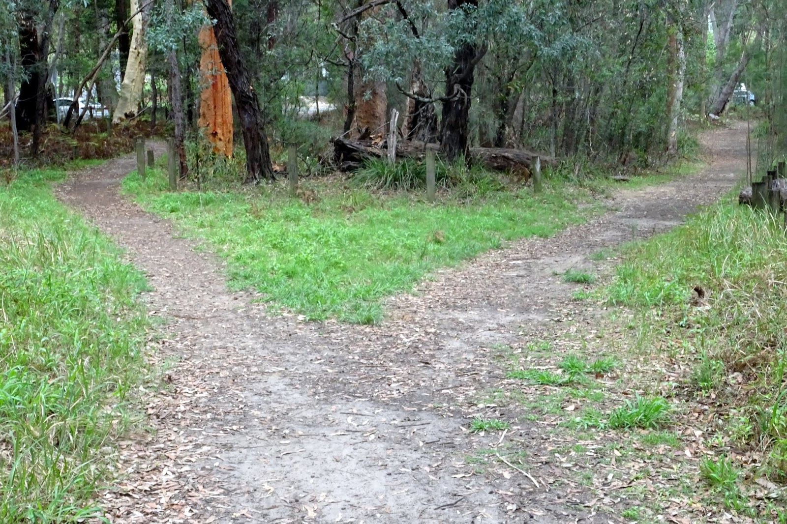
A fork in the pathway, one leading back to the car park and the other to the road.  The grass was even green, after the recent rain.


Glenbrook Lagoon is a heritage listed site located at Glenbrook in the Blue Mountains.  The Lagoon is a natural flat bottom freshwater Lagoon with an average depth of 2.7 metres and a maximum depth of 4.05 metres.  The Lagoon covers an area of 7 hectares and is fed by natural springs and also Lapstone Creek.  The Lagoon and its surrounding bushland provides an important natural sanctuary for native flora and fauna and is currently a nature reserve and area for Wetland birds.
  

Tuesday, 21 January 2020

Blackheath

Trip to Govetts Leap

Last weekend, Diane and David were staying with us and on Sunday we took a drive up the Mountains, hoping to show our guests some of the scenic wonder of the Blue Mountains.  The weather was not the best for sight-seeing as it was raining lightly, with mist descending and the further we drove up the Mountains, the mistier it became.  We were not complaining, as our drought ravaged country desperately needs rain. We decided to head for Govetts Leap in Blackheath to see the extent of the recent bushfire damage. 

We were able to drive into the car park at Govetts Leap in the Blue Mountains National Park, as it had just re-opened that day, after being closed since Christmas.  The extent of the damage is horrific.  It was still raining and a heavy mist hung over the Grose Valley, so our view from the lookout was completely obscured.  Through the mist we could distinguish the outline of burnt and charred trees where the fire had raced up the escarpments from the valley below.  The fire had come right up to the lookout itself and also the surrounding bushland around the car park.  The mist contributed to the feeling of smoke still lingering in the air.

At the Lookout, we looked down on burnt trees  and black and smouldering ground, completely stripped of any plant life, by the fire.  It was terrible to see this normally beautiful area in such a state of ruin!
Looking out in the rain and mist, surveying the damage to the bush.  The beautiful view normally visible from this Lookout was completely veiled by mist.  I shudder to think what that view would look like now!
The obelisk at the Lookout states that Govetts Leap was named after William Govett, a painter and surveyor and also the first European settler  to have visited this area.  According to the sign he first discovered this beautiful spot in June, 1831.  
The bushfire raced up the escarpments from the valley floor below, destroying all the undergrowth in its' path and burning all the trees.  The smell of smoke still lingered in the air.
The entrance to the Cliff Top Walking Track  was closed, too dangerous still to make a trek through the bush to Evans Lookout.
This tree is unrecognisable, with its burnt fronds hanging limply down.  It looks like a tree fern.  Hopefully, it will reshoot and recover.  Most indigenous trees and plants have adapted to withstand the onslaught of bushfires and do resprout and grow again.
The Visitor Centre, near Govetts Leap Lookout, was fortunately saved from the flames by the dedicated work of the volunteer RFS firefighters.  However, it is surrounded by burnt bushes right up to the front door of the Centre, evidence of how close the fire came to destroying the building!

We went inside the Centre, which was open for business.  It is well stocked with maps and tourist information for the visitors, as well as souvenirs, books and other items for sale.  We then saw a little film in the cinema room about the plants and wildlife in the Grose Valley and I just hope that in time the Valley is able to recover.

We then departed for lunch up in the township of Blackheath and a wander around the shops and antique stores, spending some money to help boost the economy, as this little township desperately  needs all the tourist dollars it can get.

Monday, 2 December 2019

Richmond

Smith Park, Pugh's Lagoon

Today we drove down to one of our favourite places, Pugh's Lagoon.  It was not a very nice day, very windy, in fact, blowing a gale.  We wanted to photograph birds and this is a great place to go to get some good shots of water birds.  There were plenty of ducks and waterfowl lying around, trying to keep out of the wind.  However, we soon found it was not the best day for photography and decided in the end we would leave it and come back on a better day.  We did manage to get a few good bird photos which I will post on instagram over the next few days. (shirleva471) 

One of the picnic sheds on the banks of the picturesque Lagoon.  Smith Park is a peaceful recreation space, ideal for a picnic and a spot of bird watching.  There is plenty of parking.  As it was such a windy day, I think the Swans and Pelicans had decided to seek shelter along the shoreline and consequently we did not see any cruising on the water.
Some of the geese, with their heads tucked under their wings, trying to protect themselves from the wind.

There are three ponds comprising the freshwater Lagoon and these wetlands are listed as an endangered ecological community.
A view between two trees of the other side of the Lagoon.

Pugh's Lagoon is named after Edward Pugh, transported to NSW as a convict in 1787.  He was later granted 100 acres of land immediately west of Richmond, near this Lagoon.
The trees on the far bank are bending in the wind.  The wind, every now and then, would whip up great gusts of dirt that appeared as a dust haze over the water.

Smith Park is divided into three specific areas and the boundaries are defined by the roads that run through it.
Some of the ducks down on the water's edge.

We also saw many Sparrows, Mynas, Willie Wagtails and Magpie Larks hopping around in the grass or flying around in the trees in the Park.